

Kiltennel A History
From the Fishermans Walk to the Bachelors Walk and beyond
Long before Courtown Harbour was built, Kiltennel has been a hive of activity. As you walk down the Burrough Road, crossing over the footbridge and on under the trees you pass by a number of areas with a hidden history.
Picture taken in 1923
The Former Cricket Ground
As you walk along the sand path, you will come across a wide open clearing locally known as the cricket pitch. It was said to have been Ireland’s first oval cricket ground' and was created by the Earls of Courtown, a title created in 1792 for the First Earl, James Stopford. Today, like much of Wexford’s soft shoreline, the area continues to battle coastal erosion. As a fixed dune system of ecological importance, please stay on the designated tracks in order to protect the surrounding biodiversity. Enjoy your walk!
The Old Bar - Remnants of the Original Harbour

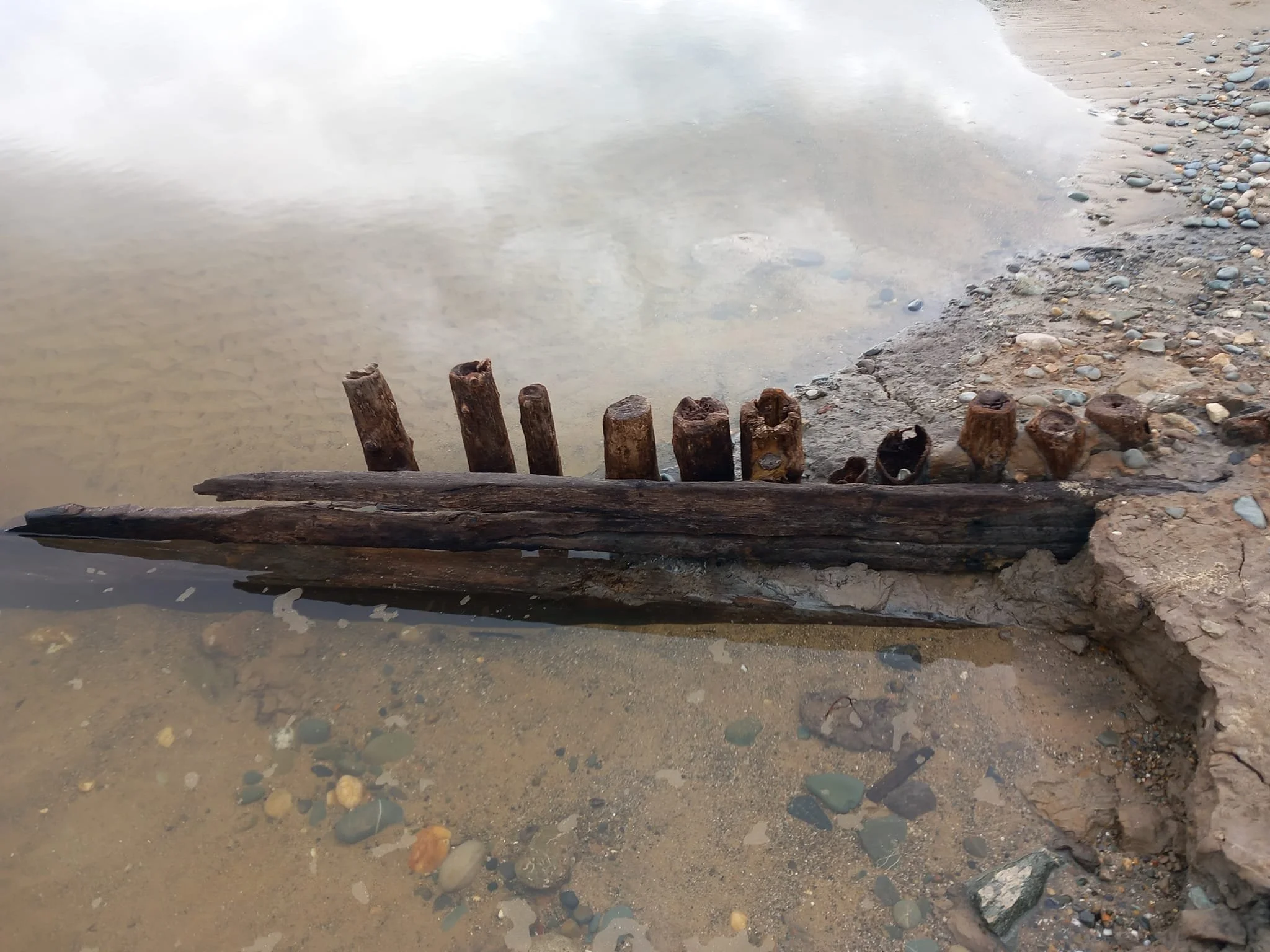
Photos Courtesy of Owen Dunbar


Reaching the end of the Burrow Road, before you cross the footbridge, take a moment to step out onto the beach. Here is the original outlet for the Ounavarra River before Courtown Harbour was built.
In 2024, after a storm, Kathleen roared through, and some of the sand was washed away to reveal old timbers, which many initially assumed were parts of a long-abandoned boat. But it was soon explained by a local history group as the last remnants of an old wooden footway and fisherman walk that stretched across the river and bar to the dunes to Ballymoney and Tara Hill.
By using this old right of way they didn't have to trespass on the Courtown Estate.
The timbers seem to have been preserved by a layer of bluey marl and sediment that was washed down the river over the year's that blocked out oxygen that would normally leads to the decay of this oak planking and round upright poles structure that probably dates from the early 1800s and possibly before.
As a famine relief system, a canal was blasted and dug through solid rock that diverted the Ounavrragh away from the bar and down the channel into the harbour or basin as most of us called it.
In heavy flood the river often reverts to it's natural course out over the bar and into the sea.
The Burrow Bridge/White Gates


Photo Courtesy of Owen Dunbar

Once a locked wooden brige at the Old Bar, the White Gates was the Earl of Courtown’s private entrance to the beach. In the 1930s, it became the gateway to Courtown Golf Links, with the original clubhouse standing nearby. The clubhouse was sold in 1980 and is now a private residence but the memory of the White Gates will forever remain part of local history.
Ref: Anna KInsella
Lady Charlotte’s Well/Wishing Well
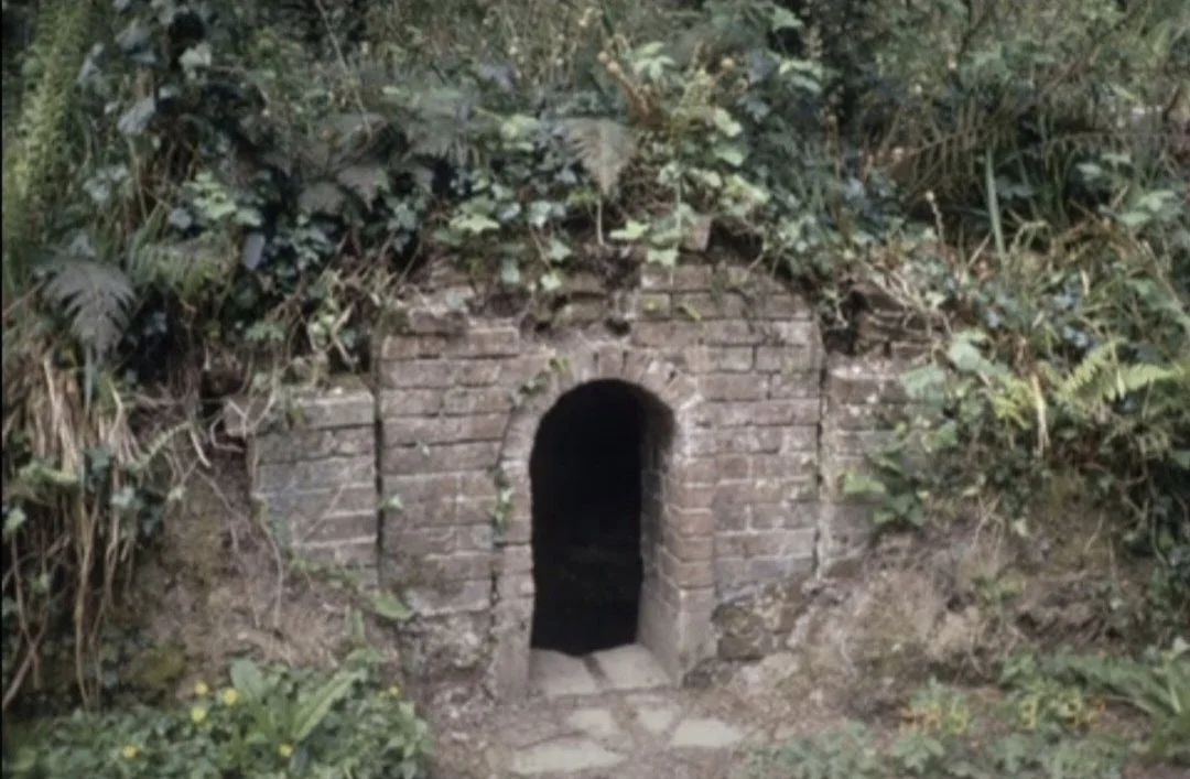

Photo Courtesy of Owen Dunbar
Constructed in the mid 1800s using locally sourced brick and lime mortar, this natural spring well is located along the picturesque Sycamore Walk. Fed by a natural spring, it once provided clean drinking water and was also used in family baptisms at Kiltennel Church, which was built in 1770 as a memorial to the Courtown Family. Over the years, generations of children have visited the well to make their wishes .
Ref ‘The Windswept Shore’ A Historty of the Courtown District by Anna Kinsella.
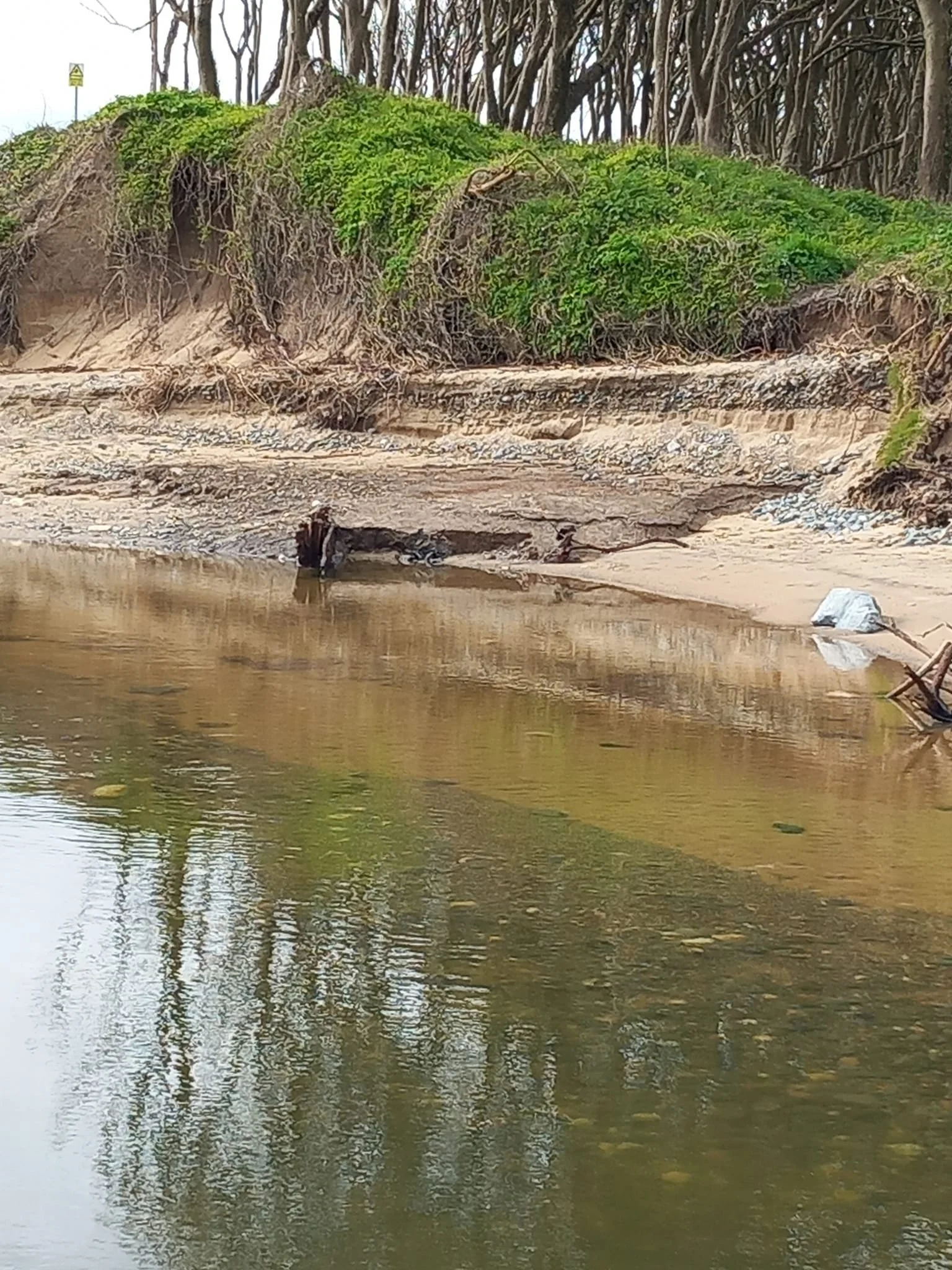
The Hazel Glen

Reaching the end of the Woodland Trail and before stepping out onto the Beach, you will reach the Hazel Glen. The stream the cuts through the land here is a low and small one, but take a moment to notice how deep the gorge is, once this tiny stream was a roaring river!
The Hazel Glen is now a Coillte Plantation and the Hazel Trees that grew here have since been replaced, but thanks to efforts by Seal Rescue and Courtown Community Council, if you look off to the far side you will see Hazel Saplings growing well!
This area marked an unofficial boundary of Lord Courtowns Estate and Fishermen from the village of Ballymoney would enter the woodlands near here.
Fishermans Way
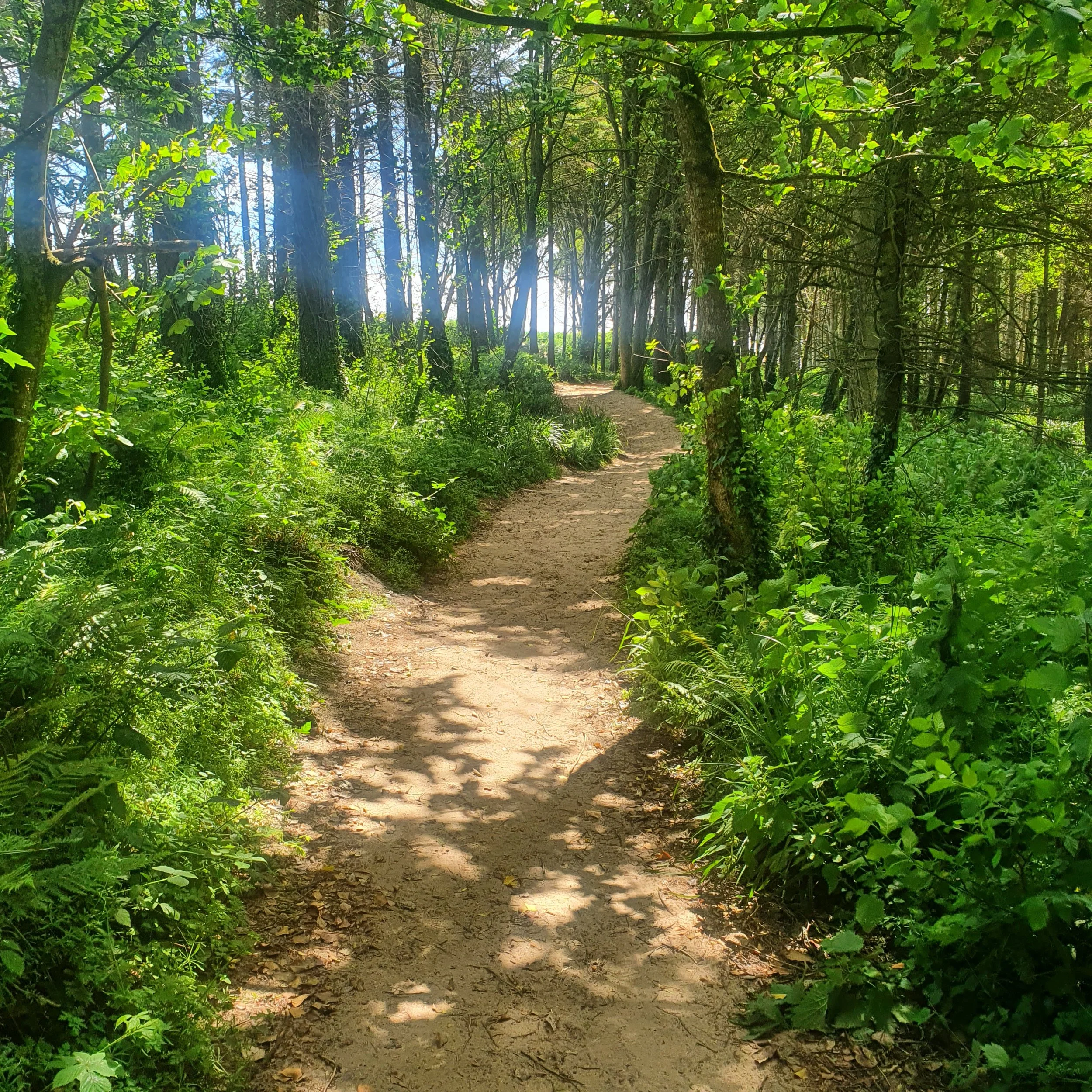
Returning towards Courtown your path leads you on the edge between the trees and sand. the path has become a little trickier in recent years due to erosion but still for the most part manageable!
This path was the route taken by fishermen living in and around the small village of Ballymoney. Each day they walked to the original opening of the river to take their boats out. Their primary catch was cod, which was sold and transported via train to Dublin.
There are many stories of smugglers, shipwrecks and hidden caves and passages along this coastline, who knows what the sea could reveal in time!
The Burrugh/Burrow

Visitors to Courtown were locally called ‘The Bathers’. From 1920 to 1938 the local hotels provided bathing huts along the foreshore of the north beach. Lord Courtown gave permission for the erection of thes huts along the sand dunes for those wishing to shelter while having tea at the beach. The rent per hut was one shilling a year. Invaribly a number of extensions were added over the years. More than thirty wooden cabins, of diverse character were built by people from Courtown, Gorey, Enniscorthy and Athy. It wasn’t unusual for owners to sub let their cabins, allowing enire families to move in for the duration of the summer season.!